The State of Soil Survey in the Philippines
The Soil Survey Division is the oldest division in the Bureau of Soils and Water Management. The first soil survey in the Philippines dates back to 1903 when Clarence W. Dorsey, an American soil scientist, classified the soils of Batangas province. But it was not until 1921 that the Division of Soils and Fertilizers was organized under the Bureau of Science. In 1933, the Bureau of Science reorganized the Division of Soils and Fertilizers into the Division of Soil Survey. In 1934, the Soil Survey Committee was organized by the Secretary of Agriculture and Commerce. It has retained its name to this day despite several reorganization history, especially after the war.
Soil Survey Division Today
Since soil survey is a primary data gathering activity, lack of sufficient funds to undertake a regular soil survey undertaking has affected the Division. Regular provincial soil survey activity has stopped since the government bureaucracy changed its planning and budgeting framework to Organizational Performance Indicator Framework (OPIF), and its major accomplishments are mostly support to other banner programs. Its provincial soil survey maps and reports available to the general public date back to pre-war years with the latest update in 2003, Nueva Vizcaya. This was a joint project with Project Cascades, a seven-year joint undertaking of the Philippine government and the European Union signed in 1997 which aims to alleviate poverty in the highlands through sustainable upland development. Prior to 2003, the last provincial soil survey updating was conducted in 1993 for Pangasinan.
Considering the fast developments and advances in soil survey and classification, staff complement is another major issue. It has a diminishing and aging work force. There is a strong need for Soil Survey Division to be staffed by soil science majors with strong background in soil survey and classification, soil morphology and genesis. But soil science background is not enough because years of field work is another essential factor to be able to conduct soil classification and mapping at field. Without an updated soil survey manual (the last Handbook of Soil Surveys for the Philippines prepared by Alfredo Barrera was published in March, 1960 yet) and keys to the Soil Series of the Philippines, even soil science majors with specialization in soil survey will have difficulties in actual field practice of soil classification and mapping.
A move towards Results Based Management (RBM) planning framework for the whole government bureaucracy would be difficult for Soil Survey Division to prove that its interventions (soil surveys) achieve the expected results (inputs to agricultural and rural development planning, policy formulation, and research). It cannot survive on a demand driven soil surveys if it were to be a regular division under a rationalized BSWM.
The Proposed Expanded Function of the Soil Survey Division
The proposed expanded function of the Soil Survey Division deals with the introduction of the two (2) sections, namely: Soil Degradation Assessment and Pedosphere Dynamics Analysis. The function is not just merely identification of soil classes and mapping the same but looking into the changes relating to soil morphogenetic features as affected by climate, geology, relief, vegetation landscape ecology and human activities over time. These factors are being studied as they affect sustainability of agricultural production, food security, land carrying capacity, human health and global biosphere. This will also include the spatial soil diversity and landscape dynamics and its various impacts to society especially to the agricultural economy. Application of environmental sociology and economic theory to validate soils and water resources as natural capital for optimization of ecosystem services.
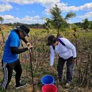
As Focal Point in the Philippines of the United Nations Convention to Combat Desertification and Land Degradation (UNCCD), the BSWM is tasked to map degraded lands in accordance with the FAO-Land Degradation Assessment (LADA) methodologies. The major approach in FAO-LADA methodology is participatory mapping of land degradation areas with the aim of enhancing community involvement in the consequent of rehabilitation efforts. This totally changes the scope and nature of soil survey from client-driver to a participating approach and technology transfer mechanism. Basic principles of transect mapping and profile characterization will be taught to clientele and stakeholders to assure data quality and uniformity of methodology in continuing efforts to establish not only baseline data but also monitoring data.
Mandate
To facilitate the development and implementation of new technologies to gather, interpret and deliver soil survey information to its diverse applications.
Mission
To provide primary soil resources information for agricultural development planning, policy formulation, and research.
Vision
A maintained and preserved rural and country atmosphere making the best use of our agricultural lands through rational soil resources utilization.
Functions
- Assess and characterize soil bio-diversity components relative to improving soil structure, fertility and productivity of various soil ecosystems
- Assess and map fertility status of soils and recommend appropriate and cost effective technologies and measures to maintain soil fertility relative to sustained productivity of agricultural areas
- Determine soil formation and lithology relevant in assessing ecosystems and landscape for their vulnerability to landslide and other risk to agricultural development
- Establish soil classification criteria, indicators and guidelines for soils/crop suitability for sustainable production
- Identify and map the location and pattern of problem soils and assess their impacts on long term productivity and determination of carrying capacity of agricultural lands
- Undertake mapping of marginal and degraded soils for proper landuse allocation in collaboration with communities/stakeholders for a rehabilitation effort
- Undertake soil taxonomic mapping as basis for the spatial distribution of locating prime, marginal and degraded lands for proper agricultural land use allocation and agro-technology transfer
Personnel
Dante E. Margate Ph. D.
Chief, Soils Survey Division (SSD)
Sandy Abiad
Maria Ivana Kay M. Abrigo
Norman A. Apura
Marjorie Arriola
Kristel Bagaua
Maria Cristina Corporal
Marcelo Dayo
Maria Elysa Del Rosario
Ronald Allan Dimaano
Ragine Galzote
Bella Noceda
Eloisa Santiago
Glenn Raymund Serrano
Sadam Silongan
Rosemarie Umagat-Silongan
Programs
Services
Contact Details
1st Floor, SRDC Bldg., Visayas Ave. cor. Elliptical Rd., Diliman, Quezon City, Philippines
(8)529-7640 local 110
+63(2) 273-2474 loc. 3226
